
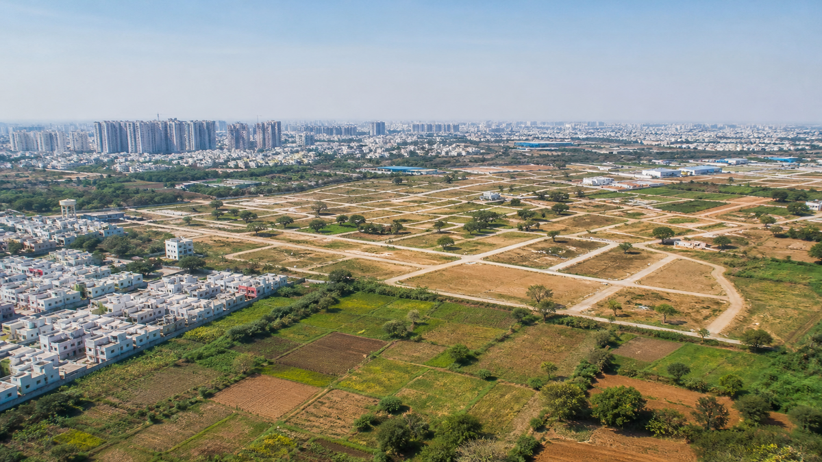
Telangana’s 10 Lakh Acre Land Survey: What the New Revenue-Forest Resolution Means for Buyers in Warangal, Khammam & Adilabad
On November 2, 2026, Telangana’s Revenue Minister Ponguleti Srinivas Reddy announced a massive, state-wide initiative to finally settle historical land disputes. The state government has ordered a comprehensive joint survey conducted by the Revenue and Forest Departments, targeting an estimated 10 lakh acres of contested land. This ambitious exercise will utilize on-ground field inspections, updated surveying technology, historical maps, and rigorous cross-checking of both revenue and forest registers to establish clear boundaries once and for all.
For property buyers and agricultural investors, this is a highly significant development. The surveys will primarily focus on resolving conflicts between revenue land and forest land, Patta land versus forest land, and boundary discrepancies found in old maps. The government has specifically pinpointed areas in the erstwhile Khammam, Warangal, and Adilabad districts—regions characterized by large forest tracts and decades-old boundary problems that have severely affected farmers and private landowners. While the minister stated he would personally monitor the progress, officials have been strictly directed to verify actual ground positions before fixing any final boundaries.
WHY THIS MATTERS FOR BUYERS & INVESTORS
Resolving land boundaries is the foundational step for property marketability, but investors must exercise extreme caution. This joint survey is strictly a land-record and boundary-resolution exercise. It is not a blanket confirmation that all affected land is privately saleable, nor does it mean the land is automatically eligible for real estate development.
The contrast between clear-title urban land and disputed rural parcels is stark. In October 2026, reports indicated that government land values across Telangana were revised, with western Hyderabad growth corridors seeing increases of approximately 25% to 75%. Established HMDA areas like Kokapet now command government residential equivalent values of about ₹13 crore per acre (roughly ₹27,000 per sq. yd.), while commercial equivalents sit around ₹23 crore per acre. However, these booming urban metrics cannot and should not be extrapolated to the disputed rural parcels in northern and eastern Telangana.
For the next one to three years, land awaiting survey results in Khammam, Warangal, and Adilabad will remain highly speculative. The marketability and appreciation of these parcels will depend entirely on the official classification, the removal of registration restrictions, and the establishment of clear private title. Disputed or forest-adjacent land may remain illiquid even if it is advertised by local brokers at a steep discount. True demand will only follow once the boundary is confirmed and legal road access is officially documented.
QUICK FACTS
| Detail | Information |
|---|---|
| Location Focus | Erstwhile Khammam, Warangal, and Adilabad districts, Telangana |
| Current Price/Rate | Highly variable; no reliable government price list published for the 10-lakh-acre survey zones. (Urban benchmarks like Kokapet sit at ₹13Cr/acre, but rural rates differ drastically based on title clarity). |
| Approval Status | Survey pending. Does NOT grant HMDA, DTCP, or RERA approval. |
| Connectivity | NH-44 (Adilabad), NH-163 & rail hub (Warangal), NH-365/NH-65 (Khammam) |
| Possession/Launch Date | Not yet announced (No village-wise schedule or completion deadline provided yet) |
WHAT YOU NEED TO KNOW
The core of this initiative is to untangle the complex web of overlapping land claims. Historically, discrepancies between the revenue department’s pahani/adangal records and the forest department’s conservation maps have left thousands of acres in legal limbo. Before any land in these regions can be safely purchased, officials must verify the ground reality. Until a final survey map and parcel list are published, any land bordering forest zones in these districts should be treated as a high-risk asset.
Location and connectivity play a major role in the long-term value of these lands, but distances can be deceptive. While the Adilabad region is connected via NH-44 on the Hyderabad-Nagpur route, Warangal relies on NH-163 and its major railway hub, and Khammam utilizes the NH-365/NH-65 corridors. However, for any specific rural parcel, buyers must independently verify the exact survey number, the mandal, and the distance to the nearest paved public road. A dirt path shown on a broker’s brochure does not guarantee legal public road access.
Furthermore, buyers must understand the strict limitations of this government exercise. A finalized joint survey does not automatically convert agricultural land for non-agricultural use, nor does it approve an individual house or layout. Before committing to any purchase, investors must independently verify the forest status, conduct a 30-year title search, and check the Telangana prohibited-property list. Claims of a property being within “HMDA limits” or “DTCP areas” mean nothing without an actual, verifiable layout approval number from the issuing authority.
PRO TIPS FOR BUYERS
- Do not rely on a broker’s survey sketch: Always obtain certified government records for the exact survey number, subdivision, extent, and boundaries before negotiating.
- Insert conditional clauses: Make your sale agreement explicitly conditional on satisfactory title verification, forest-status clearance, registration eligibility, and legal road access.
- Hire independent professionals: Use an independent property lawyer and a licensed surveyor to ensure the sale deed, revenue map, and physical ground boundaries perfectly align.
- Verify approvals directly: Check the project directly on official HMDA, DTCP, and Telangana RERA portals. Never accept screenshots, glossy brochures, or vague “approval applied” claims as proof of legal compliance.
- Avoid cash advances on disputed land: Pay only through traceable banking channels and avoid handing over large cash advances until the seller’s title is consistently proven in the latest revenue and registration records.
Also Read
5 Land Measurement Conversions: Hectares, Guntas, Acres, and More
FAQ
Does the new 10 lakh acre joint survey mean the land is approved for real estate development?
No. The joint survey is strictly a boundary-resolution and land-record exercise between the Revenue and Forest Departments. It does not grant HMDA, DTCP, or RERA approvals, nor does it automatically convert agricultural or forest land for residential or commercial real estate use.
Which districts in Telangana are covered under this new land survey?
The government has specifically identified areas in the erstwhile Khammam, Warangal, and Adilabad districts. These regions are the primary focus due to their large forest tracts and historical boundary disputes between revenue and forest lands.
When will the Telangana joint land survey be completed?
As of the November 2, 2026 announcement by Revenue Minister Ponguleti Srinivas Reddy, the government has not yet provided a village-wise schedule, a final parcel list, or a specific completion deadline for the survey.
Planning to Invest in This Area?
Don’t decide blindly! Browse verified listings or talk to a BigProperty.in property expert before you finalize your decision. Have a question about this locality? Drop it in the comments below.
null

