
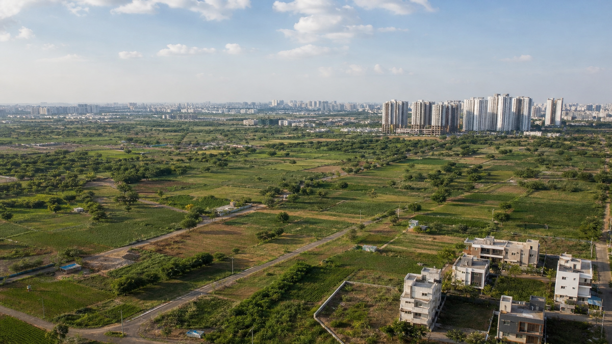
Telangana Land Survey 2026: What the 10 Lakh Acre Dispute Resolution Means for Property Buyers
In a massive move that will reshape the real estate landscape across the state, the Telangana government has officially ordered a joint Revenue and Forest Department survey to resolve long-standing boundary disputes. As of the latest update on November 2, 2026, this ambitious administrative exercise targets an estimated 10 lakh acres of contested revenue, patta, government, and forest land. Officials are deploying modern survey technology, field inspections, and historical revenue maps to finally fix boundaries that have been blurred for decades.
For home buyers and real estate investors, this development is a double-edged sword. While it promises to eventually bring much-needed transparency and clear titles to the market, it also serves as a stark warning. With massive tracts of land currently under scrutiny—especially in areas associated with the erstwhile Khammam, Warangal, and Adilabad districts—purchasing property without rigorous title verification has never been riskier. A recent Supreme Court ruling regarding government land in Hyderabad’s Miyapur perfectly illustrates why buyers must pay close attention to this ongoing statewide land-record cleanup.
WHY THIS MATTERS FOR BUYERS & INVESTORS
The resolution of these boundary disputes will have a direct and lasting impact on property availability, legal safety, and investment timelines across Telangana. However, buyers must understand that there is no single applicable market rate for the 10 lakh acres currently under the scanner. The survey covers a vast array of districts, land categories, and rural-urban locations.
If you are looking at disputed, forest-claim, or unclear-title land, be aware that no reliable investment price should be assigned to these parcels. A low quoted rate from a broker is not evidence of value; it is often a red flag for legal trouble. For clear agricultural land in interior Telangana, prices will continue to vary substantially based on the district, irrigation facilities, road frontage, and proximity to major towns. Buyers should obtain at least three recent registered-sale comparables before entering any negotiations.
In the urban and peri-urban sectors, such as approved residential plots near Hyderabad, rates must be checked locality by locality using recent registered transactions. The ongoing survey does not automatically establish private ownership or grant layout approvals. In fact, it may confirm government or forest ownership, freezing disputed parcels during objections, appeals, or court proceedings. Investors are strongly advised to underwrite a zero percent appreciation assumption on any land until the title, approval status, and market comparables are independently and legally verified.
QUICK FACTS
| Parameter | Details |
|---|---|
| Location Focus | Statewide, primarily erstwhile Khammam, Warangal, Adilabad districts, and specific Hyderabad zones (e.g., Miyapur). |
| Current Price/Rate | Varies widely by district and land type; no single official rate applies to the disputed 10 lakh acres. |
| Approval Status | Administrative land-record exercise only (Does not grant HMDA/DTCP layout approvals or building permissions). |
| Connectivity | NH-30, NH-365 (Khammam), NH-163 (Warangal), NH-44 (Adilabad), and Hyderabad Metro/ORR (Miyapur). |
| Possession/Launch Date | Ongoing phased resurvey; Phase 1 covering 2,720 villages is currently active. |
WHAT YOU NEED TO KNOW
The state government is leaving no stone unturned in its quest to digitize and secure land records. To verify the physical position of land against title records, survey maps, and departmental boundaries, the government is utilizing advanced scientific methods. This includes the use of Differential Global Positioning Systems (DGPS), Geographic Information Systems (GIS), Quantum GIS (QGIS), and survey rovers. The state is actively procuring additional equipment beyond the 411 rovers already available to expedite the process.
It is important to note that this joint Revenue-Forest survey is operating alongside a broader statewide resurvey being conducted in phases. The first phase of this broader resurvey covers 2,720 villages—specifically 70 villages in each of the 32 districts, excluding Hyderabad. Work has already been completed in 285 villages, with notices issued to landowners to submit any objections. Ultimately, the goal is to assign a unique “Bhudhaar” number to each survey number, with all digitized records uploaded to the centralized Bhu Bharathi system.
A landmark legal development in Hyderabad perfectly highlights the stakes of this exercise. On October 29, 2026, the Supreme Court upheld the state government’s ownership of 550.39 acres in Miyapur Survey Nos. 100 and 101. The apex court ruled that the land is government poramboke land, effectively quashing private ownership claims. A subsequent field survey revealed that about 400 acres remain vacant, while around 150 acres have been encroached upon. The government is currently estimating this Miyapur asset at approximately ₹50,000 crore and is considering protecting, developing, or auctioning the vacant parcels. Buyers must remember this is a government asset valuation, not a residential per-square-foot market rate.
PRO TIPS FOR BUYERS
- Match the ground parcel to the records: Never buy land based solely on a site visit. Hire a licensed surveyor to confirm the GPS coordinates, physical boundaries, total extent, and access roads against the official cadastral map.
- Buy only after written title clearance: Obtain an independent property lawyer’s report covering at least 30 years of title history. Ensure they check for court cases, government claims, forest status, and prohibited-property records.
- Verify approvals with the issuing authority: Independently check HMDA or DTCP layout approvals, land-use conversion certificates, and Telangana RERA registration. Do not rely on a developer’s glossy brochure or a forwarded WhatsApp certificate.
- Use registered comparables: Compare recent registration values and completed transactions in the exact same village or locality. Adjust your valuation for road frontage, agricultural conversion status, water, electricity, and overall development.
- Make the agreement conditional: Protect your capital by requiring refund and indemnity clauses in your agreement of sale, specifically triggering if survey objections, litigation, forest claims, or approval defects emerge before registration.
Also Read
Top 10 Best Real Estate Builders Developers In Hyderabad
Patancheru The Emerging Destination
An Over View On Hyderabad Orr Exit Number 7 Shamirpet
What Is Bhk In Real Estate A Comprehensive Guide To Bhk Full Form And Usage
FAQ
Does the new Telangana land survey mean my property is legally approved for construction?
No. The joint survey is an administrative land-record and boundary-resolution exercise. It does not act as a blanket approval for construction or plotting. You still need valid HMDA or DTCP layout approvals, RERA registration, and land-use conversion before building.
Is it safe to buy residential plots in Miyapur Survey Nos. 100 and 101?
Any private sale claim connected to Miyapur Survey Nos. 100 or 101 requires extreme caution. On October 29, 2026, the Supreme Court upheld the state’s ownership of 550.39 acres in these specific survey numbers, confirming it as government poramboke land, not privately owned property.
What is a Bhudhaar number in Telangana real estate?
A Bhudhaar number is a unique identification number intended for each surveyed land parcel in Telangana. As part of the ongoing resurvey, these digitized records and unique IDs will be uploaded to the Bhu Bharathi system to streamline revenue records and improve transparency for buyers.
Planning to Invest in This Area?
Don’t decide blindly! Browse verified listings or talk to a BigProperty.in property expert before you finalize your decision. Have a question about this locality? Drop it in the comments below.
null

