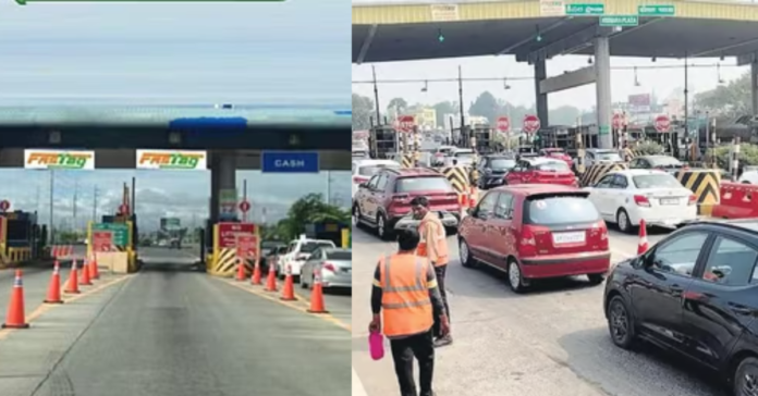
The Indian government has recently implemented significant changes to toll collection rules, introducing a satellite-based toll collection system that allows drivers to pay tolls based on the distance they cover. This innovative approach aims to modernize the tolling process, enhance efficiency, and provide financial relief to short-distance travelers.
Introduction to the New Toll Collection System
On September 10, 2024, the Ministry of Road Transport and Highways announced amendments to the National Highways Fee (Determination of Rates and Collection) Rules, 2008. The new regulations introduce a Global Navigation Satellite System (GNSS) for toll collection, which will work alongside the existing FASTag system and Automatic Number Plate Recognition (ANPR) technology. This transition marks a pivotal shift in India’s transportation infrastructure, moving away from traditional toll booths to a more streamlined, automated process.

source: Khabar india
The Indian government is set to transform the toll collection landscape with the introduction of the GNSS-Based Toll Collection system. This innovative approach leverages satellite based toll collection to enhance the efficiency and effectiveness of tolling on national highways. With the recent government changes to toll collection rules in India, the GNSS toll system is poised to offer a seamless, distance-based tolling experience for all road users.
The updated system, which employs Global Navigation Satellite System (GNSS) technology for tracking, allows users of mechanical vehicles—excluding those with a National Permit—to travel up to 20 kilometers without incurring any toll fees.
According to the new rules, drivers, vehicle owners, or those responsible for the vehicles will not be charged for trips that cover a distance of up to 20 kilometers in either direction on toll roads, including national highways, permanent bridges, bypasses, and tunnels. For trips that exceed this distance, motorists will be billed based on the actual kilometers traveled.
Understanding the GNSS-Based Toll System
The GNSS toll system utilizes the Global Navigation Satellite System (GNSS) to track vehicles in real-time, enabling accurate toll calculations based on the distance traveled. Unlike traditional tolling methods, which often involve fixed charges at specific points, the new toll rules allow for Distance-Based Toll Charges. This means that drivers will only pay for the distance they cover on tolled roads, making it a fairer system for users who travel shorter distances.
Also read: What are the Toll Gate Charges for LCVs & Mini Buses On ORR?
Key Features of the GNSS Toll System
- Real-Time Tracking:
- The GNSS system enables real-time tracking of vehicles, allowing for efficient toll collection and monitoring. This feature ensures that tolls are accurately calculated based on actual usage.
- Barrier-Free Tolling:
- One of the most significant advantages of the GNSS-based system is its ability to facilitate barrier-free tolling. Vehicles equipped with GNSS technology can pass through virtual toll booths without stopping, reducing congestion and improving traffic flow.
- Reduced Infrastructure Costs:
- By eliminating the need for extensive physical infrastructure, such as toll booths and gantries, the GNSS toll system significantly lowers operational costs for toll authorities. This reduction in infrastructure investment allows for more efficient use of resources.
- Flexible Toll Charges Rules:
- The GNSS toll-based rules allow for various charging schemes, including distance-based, time-based, and congestion-based tolling. This flexibility enables a more equitable toll collection system that caters to the diverse needs of road users.
- Integration with Existing Systems:
- The GNSS-based tolling system will initially operate alongside the existing FASTag system, creating a hybrid model that ensures compatibility and a smooth transition for users.
toll collection Calculator
Benefits of GNSS Toll Collection system
- Distance-Based Tolling:
- The system allows for toll charges based on the actual distance traveled by the vehicle, promoting a “pay-as-you-use” model. This means users only pay for the distance they cover on tolled roads.
- Virtual Toll Booths:
- GNSS-based tolling utilizes virtual toll booths instead of physical toll plazas. Vehicles equipped with GNSS technology can pass through these virtual toll points without stopping, which significantly reduces congestion and travel time.
- Seamless Transactions:
- Toll amounts are automatically deducted from a digital wallet linked to the vehicle’s On-Board Unit (OBU) as it passes through virtual gantries, ensuring a frictionless and cashless tolling experience.
- Use of Indian Satellite Navigation Systems:
- The system incorporates India’s satellite navigation systems, such as GAGAN (GPS Aided GEO Augmented Navigation) and NavIC (Navigation with Indian Constellation), enhancing accuracy and coverage for toll collection.
- Enhanced Traffic Flow:
- By eliminating the need for physical toll booths, the GNSS system is expected to improve traffic flow on highways, leading to faster commutes and reduced congestion during peak hours.
- Scalability:
- The GNSS-based toll system is designed to be scalable, allowing for easy expansion to cover larger road networks and adapt to increasing traffic volumes without significant infrastructure investment.
- Integration with Existing Systems:
- The GNSS-based tolling system will initially coexist with existing FASTag systems, allowing for a gradual transition and compatibility with older vehicles.
Differeneces Between GNSS-Based Tolling System and FASTag
The GNSS-based tolling system introduces several advancements and differences compared to the existing FASTag system. Here’s a comparison of the two systems: GNSS vs Fastag
Comparison of GNSS-Based Tolling System and FASTag
| Feature | FASTag | GNSS-Based Tolling |
|---|---|---|
| Technology | Uses RFID (Radio Frequency Identification) | Utilizes Global Navigation Satellite System (GNSS) |
| Toll Booth Requirement | Requires physical toll booths for scanning | Employs virtual toll booths, eliminating the need for physical booths |
| Payment Method | Pre-paid recharge required on linked account | Supports both pre-paid and post-paid billing based on distance traveled |
| Travel Experience | Vehicles must stop at toll booths | Vehicles can pass through without stopping, ensuring a seamless experience |
| Congestion Management | Can still experience queues during peak hours | Aims to reduce congestion significantly by allowing free-flowing traffic |
| Distance Tracking | Charges are fixed per toll plaza | Charges based on actual distance traveled |
| Integration | Currently in use across India | Will be integrated with FASTag in a hybrid model for a smooth transition |
| User Experience | Faster than cash lanes but still requires stops | Provides a barrier-free experience with no stops required |
| Operational Efficiency | Improvements over cash collections, but still limited by physical infrastructure | Expected to drastically reduce wait times and improve traffic flow |
| Data Collection | Limited to transactions at toll booths | Allows for real-time tracking of vehicles and traffic patterns |
Detailed Insights
- Toll Booth Requirement:
- Traditional Systems: Require physical toll booths where vehicles must stop for FASTag scanning, which can lead to delays and congestion.
- GNSS-Based Tolling: Employs virtual toll booths that monitor vehicle entry and exit without requiring stops, enhancing traffic flow.
- Technology Used:
- Traditional Systems: Utilize RFID technology for toll collection.
- GNSS-Based Tolling: Leverages satellite technology for precise vehicle tracking and toll calculation.
- Payment Process:
- Traditional Systems: Involves manual scanning of FASTags at toll booths.
- GNSS-Based Tolling: Automatically deducts tolls based on the distance traveled, streamlining the payment process.
- Traffic Flow:
- Traditional Systems: Often experience congestion, especially during peak hours due to the need for vehicles to stop.
- GNSS-Based Tolling: Aims to eliminate congestion by allowing vehicles to maintain speed without stopping.
- Distance-Based Charging:
- Traditional Systems: Charge fixed tolls at specific points, which may not reflect the actual distance traveled.
- GNSS-Based Tolling: Charges based on actual distance traveled, offering a fairer pricing model.
- Infrastructure Costs:
- Traditional Systems: Incur high costs due to the need for extensive physical infrastructure.
- GNSS-Based Tolling: Reduces infrastructure costs by eliminating the need for physical toll booths.
- User Experience:
- Traditional Systems: Require drivers to stop at toll booths, leading to longer travel times.
- GNSS-Based Tolling: Provides a seamless experience, allowing for uninterrupted travel.
- Real-Time Tracking:
- Traditional Systems: Limited to tracking at specific toll points.
- GNSS-Based Tolling: Offers continuous tracking, enabling efficient toll management and monitoring.
- Integration with Existing Systems:
- Traditional Systems: Operate independently of other systems.
- GNSS-Based Tolling: Designed to integrate with existing FASTag systems, facilitating a smooth transition for users.
Also read: What are the Toll Gate Charges for LCVs & Mini Buses On ORR?
GNSS-based tolling real-time tracking and monitoring
The GNSS-based tolling system facilitates real-time tracking and monitoring through several key mechanisms:
Real-Time Tracking and Monitoring in satellite based toll collection
- Satellite Communication:
- The GNSS system utilizes satellite technology to continuously monitor the location and movement of vehicles equipped with GNSS-enabled devices. This allows for precise tracking of vehicles as they travel along toll roads.
- Automated Data Collection:
- As vehicles pass through virtual toll points (gantries), the GNSS system automatically collects data on their location, speed, and distance traveled. This data is transmitted in real-time to a central system for processing.
- Accurate Toll Calculation:
- The system calculates toll charges based on the actual distance traveled by each vehicle. By using real-time data, it ensures that users are charged accurately according to their usage of the tolled road.
- Traffic Pattern Analysis:
- The data collected through GNSS technology provides valuable insights into traffic patterns and vehicle flow. Authorities can analyze this information to optimize traffic management, identify congestion points, and improve road infrastructure planning.
- Enhanced Operational Efficiency:
- Real-time tracking allows for immediate identification of toll evasion or discrepancies in toll payments. This capability enhances operational efficiency by reducing revenue leakages and ensuring that toll authorities can respond promptly to any issues.
- User Notifications:
- The system can provide users with real-time notifications regarding their toll charges and travel patterns, enhancing transparency and user engagement.
- Integration with Other Systems:
- GNSS-based tolling can be integrated with other traffic management systems, enabling a comprehensive approach to monitoring and managing road usage. This integration can facilitate coordinated responses to traffic incidents and improve overall road safety.
Frequently Asked Questions:
The government has introduced a satellite-based toll collection system that charges drivers based on the distance traveled, with no toll fees for the first 20 kilometers.
Vehicles equipped with GNSS On-Board Units (OBUs) will automatically pay tolls based on the distance covered, eliminating the need for manual payments at toll plaza
No, there will be no toll charges for the first 20 kilometers traveled in a single day, benefiting short-distance travelers.
The new system utilizes Global Navigation Satellite System (GNSS) technology alongside existing FASTag and Automatic Number Plate Recognition (ANPR) systems
Suggested Articles:
What are the Toll Gate Charges for LCVs & Mini Buses On ORR?
Vehicle-Wise Toll Gate Prices on Outer Ring Road (ORR)
What are the Toll Gate Charges for Cars (LMVs) On ORR?


